TL;DR - Drive out of Yellowstone into Wyoming and Montana, drive across Montana to the North Dakota border and then cut south as soon as I can into South Dakota, detour a bit to see Devil's Tower in Wyoming, then stop for the night in Deadwood, SD.
Theme songs:
- "Life Is a Highway" (Tom Cochrane) for my drive
- "Theme from Close Encounters of the Third Kind"
I knew this was going to be a really long day, somewhere in the neighborhood of 13-15 hours or so.
In my haste to leave Yellowstone around 7am, I left one of my camera batteries and my only charger plugged in. I didn't realize it until I checked in at Deadwood late that night, called them the next day, and had them ship it to my hotel in Chicago where I was going to be in a few days. I still had 3 batteries, but that had to last me for the rest of the trip (but at least I had my phone and charger). Fortunately, tomorrow was the last main sightseeing day with Wednesday being just going south to Denver with nothing much along the way.
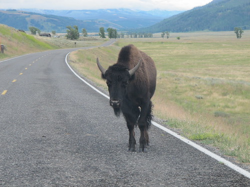
Took a while just getting out of the park, there's a lot of the Little America plains to go through - some of which I had done the night before - and lots of buffalo on the road. They're bigger, and they don't obey traffic signs.
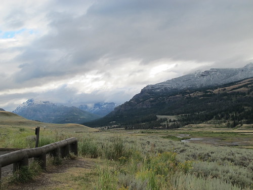
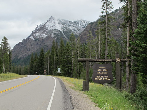
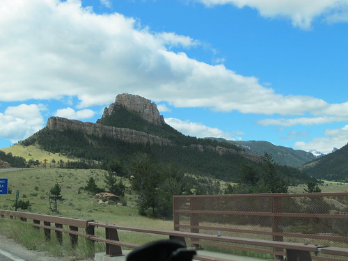
The original plan was to leave around 7am and go east out of Yellowstone to Cody WY on US 14, then cut north to Billings MT via Alt-14 and US 310, and on my way east, stop at the Little Bighorn Battlefield National Monument an hour outside of Billings around lunchtime, time and desire permitting. But a Facebook friend who had just done this area a couple months earlier recommended that I take the Beartooth Scenic Highway northeast out of Yellowstone instead, it's supposed to be amazingly scenic ride up US 212 through the Custer Gallatin National Forest and the mountains, from Cook City-Silver Gate up through Red Lodge. That route would take me into Billings.
It sounded like a good idea at the time. This is what I would have done.

Continuing on I-94 east from Billings to Miles City, I'd then get on US 12 going east into North Dakota. Why? Because I figured the chances of me ever getting back near North Dakota were next to non-existent, thus making the trip out of the way just so I could say I was in the state and it's not an urban legend like I had always assumed. I mapped out the smallest chunk of ND that I could get through while still staying on the highways and not the back roads, it ended up being about 50 miles in the state total.
If not for that, I would have saved a couple of hours of driving, as my road trip then went south out of Bowman ND down to Belle Fourche SD, where I then backtracked west into Wyoming to see Devil's Tower (I could have gone south from Miles City more or less straight to Devil's Tower) - this is where the aliens landed in "Close Encounters of the Third Kind". My deadline was to hit this area by sunset, as my only stop after this was for the night in Deadwood.
My Facebook friend also told me that a lot of this area outside the cities doesn't have cell phone service, so bring my Garmin GPS. Daylight is about 5am til 9:30pm. And to make sure that I top off my gas tank when I can.
Google Maps told me that my trip was 270 miles (5:20) from Yellowstone to Little Bighorn, 428 miles (6:56) from there to Devil's Tower, then 77 miles (1:17) to Deadwood. That's 13-1/2 hours with no stops, which would be my longest solo driving trip. If I leave at 7, I get to Little Bighorn around 12:30, then spend a half hour or so then it's 1pm, cross into North Dakota about 5pm, Devil's Tower around 8pm (sunset is 8:30pm), so I'd get to Deadwood about 9pm. I'll probably have to grab lunch and eat on the road.
It sounded good on paper, but battle plans never survive contact with the enemy.
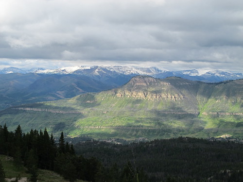
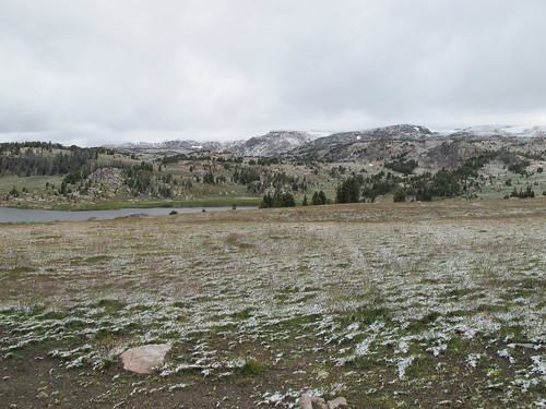
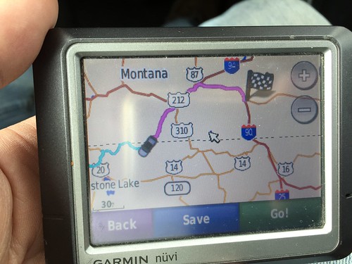
If there was a sign that told me that the Beartooth Highway was closed due to an avalanche (in July!!!) about 10 miles down the road, I must have missed it, and I wouldn't have gone that way. But I did miss it, and did go down the road. What I did get to see was amazing vistas of mountains and forest. Then I got to the parts of the road that were getting icier and more snow-covered. And the sign that said ROAD CLOSED. Of course, up there I couldn't get a phone signal, so no GPS mapping on my phone, but I did have my trusty Garmin GPS (which I hadn't used in years) - but it would only tell me to keep going in the closed direction, there was no way to get it to re-route like I could have done with Google Maps. I had to manually zoom in enough to find the next best route. And then I remembered that I had picked up some paper maps back at the Idaho rest stop for Wyoming and Montana, so with the GPS telling me where I was, I could use the paper maps to tell me which way to go to get to where I wanted. Old school navigation!
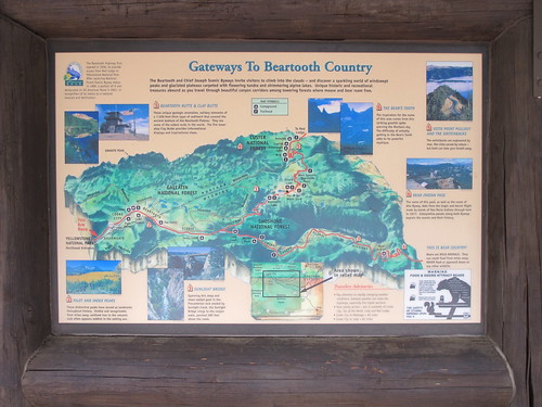

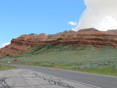
The alternate route took me back until I could pick up SR 296, Crandall Road, going southeast past Dead Indian Summit Overlook (about where the red pin is at lower right) onto Dead Indian Hill Road until I got to SR 120, Black and White Road (named for colored rock formations), which becomes SR 72 Belfry Highway because it runs into Belfry WY.
Then keep going north through Bridger into Rockvale, where I FINALLY hook back up with US 212 which was what the Beartooth turns into after it leaves the mountains. Rockvale is at the intersection of 310 and 212.

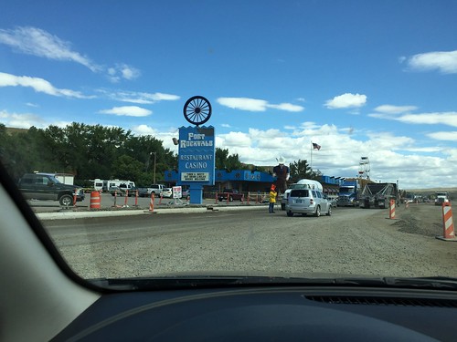
That detour, from when I took the picture of my GPS before turning around until I got to Rockvale, took me 3 hours and put me 90-120 minutes behind schedule. So I had to leave Little Bighorn on the list of things to see next time - it was either that or Devil's Tower. And of course, there's a traffic jam going north into Rockvale, because they had chosen that week to do road construction right there at the intersection of US 212 and 310 and cut everything down to a single lane. There's even a casino right at that intersection, who would have thought there'd be one in BFE Montana?
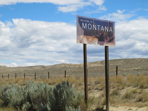
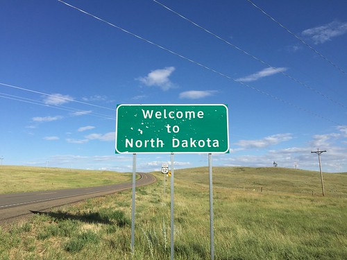
Stopped for lunch in Billings around 1:15, then back on the road headed east on I-94. Got stopped for speeding somewhere between Billings and Miles City, apparently I hadn't noticed the slower speed limit signs as I got close to a town, but the cop took pity on me (seeing that I was a tourist) and let me go with a warning. Yay! Past Miles City at 4:15, then east on US 12 towards the North Dakota border. I saw the sign, but I wasn't sure if someone was playing an elaborate prank and that North Dakota is still really just an urban legend, but I at least got a picture of the sign at 5:40. I'm now more aware of the clock, I've only got 3 hours to get to Devil's Tower before sunset.

North Dakota was really flat and really boring. This is going south, not that it matters.

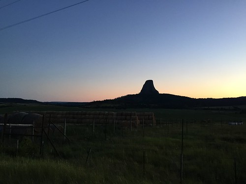
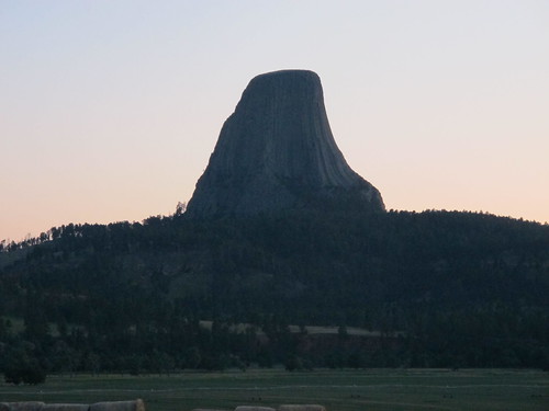
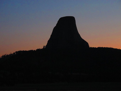
Just south of Belle Fourche, SD, you can take SR 24 west toward's Devil's Tower.

If you have plenty of time and want to go to Devil's Tower National Park, it's $10 to get in and takes several hours to walk around the base. I had neither the time nor inclination to do that, but all you really need to do is wait til it's in sight and then pull off the road for your pictures. I got there at 8:45, just as the sun was setting, so I got to see sunset colors in the sky and then growing darker. I had my camera on my tripod taking time exposures, and I put the theme from "Close Encounters" on my phone speaker, but I did not see any UFOs.
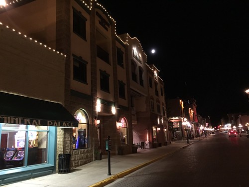
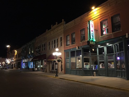
Left the area around 9:15, stopped for a quick bite somewhere, and finally pulled into Deadwood around midnight (that's the green pin in the bottom right corner of the map). I stayed at Hickok's Hotel & Gaming because it was in my price range. Remember, it's Tuesday night, and the big motorcycle rally starts in Sturgis on Friday, so things were picking up. After checking in, I got something to eat, played a little video poker (lost $5), and walked down the main street for a bit before bed.
Left at 7am, stopped for the night around midnight. That's 17 hours, with stops, but still longer than I had originally planned. Oh well.


No comments:
Post a Comment